GRS specialise in landslide hazards in mountainous and tropical regions.
Landslides are controlled by complex and often inter-related geological and geomorphological factors. With an in-depth understanding of the processes, GRS provides clear insight into the problem, allowing for the rapid and cost effective evaluation of the risk and, where appropriate, detailed analysis and mitigation design.
For example, in 2008 and on behalf of Scott Wilson Limited, GRS mapped and evaluated specific engineering geological problems associated with sections of a new 139km mountain road through landslide prone terrain in Ethiopia.
In 2008 the Hong Kong Government commenced a 10-year programme of Landslip Prevention and Mitigation (LPMit), focusing on the risk from natural slopes rather than that of man-made slopes, and GRS have been retained as a specialist sub-consultant on over half of the agreements let to date (February 2012) which have values of between US$0.8M and US$3.5M.
GRS were also involved in a regional landslide hazard assessment following a major rainstorm which initiated over 1600 landslides on Lantau Island, Hong Kong.
Following this work detailed catchment specific assessments (please note: large file) were undertaken.

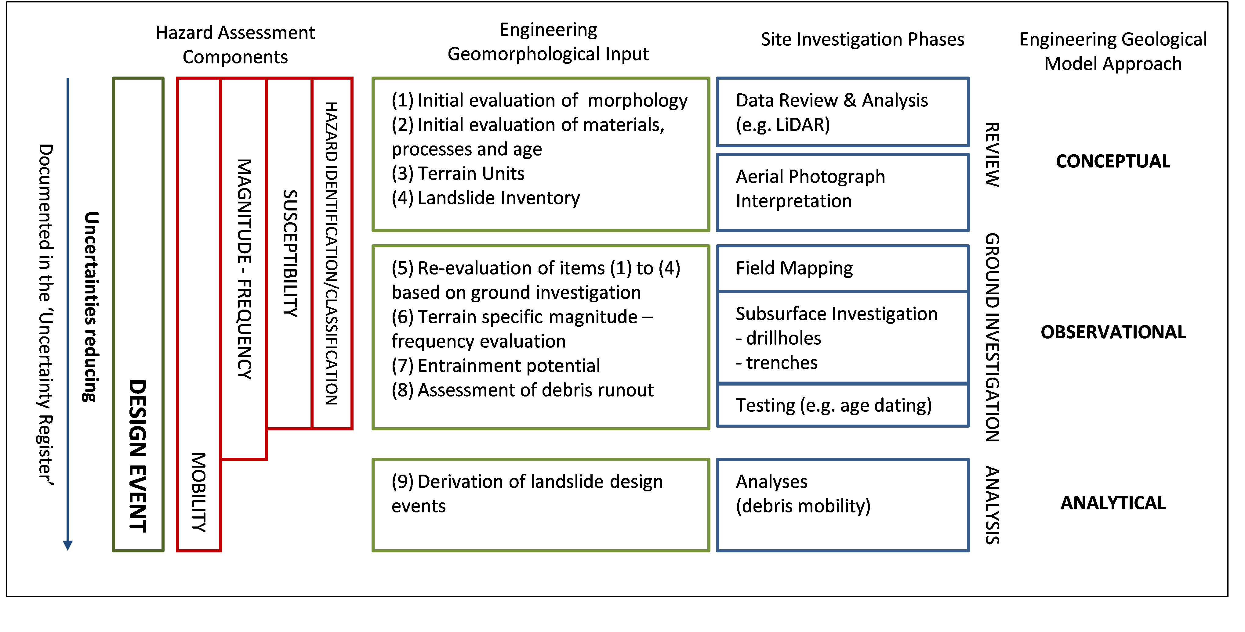
The key aspects of a geohazard assessment, including the engineering geological input are illustrated in this Figure. This approach is discussed in detail in Parry, S., Hart, J.R. & Moore, A.J. (2009) Reducing Uncertainty in Natural Terrain Hazard Studies: the Role of the Engineering Geologist. Proceedings of the 29th Annual Seminar, Geotechnical Division, Hong Kong Institution of Engineers. pp 61-70.
